日本全国の錦絵・写真等を紹介する新しい電子展示会「錦絵と写真でめぐる日本の名所」を公開しました。
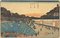
Akabane
Back : Find on a modern map Back : Find on a detailed map of Edo Back : Minato-ku Back : Shiba Atago-shita ezu
- Current Address
- Minato-ku, Mita
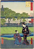
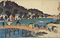
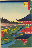
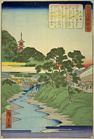
- Description
- The name of the area to the southwest of Zojo-ji Temple between the Akabane-bashi Bridge spanning the Akabane-gawa River (the regional name for the Furu-kawa River) and the Nakano-bashi Bridge. There are several theories regarding the origin of the area name including one that states that it is a corruption of "akahani" (for red soil) because the area had red soil since long in the past. From the Meireki Era (1655-1658) onward, the Kurume Clan Arima family residence occupied the entire area. The residence featured the highest fire watch-tower in Edo, the Suiten-gu Shrine that enshrined the suijin water god of the Chikugo-kawa River, and general worship was allowed on the Ennichi (festival day) on the 5th of every month. The shrine was said to answer prayers for finding items lost in the water, and for easy births, it was very popular, but in 1871, the shrine was moved to Aoyama in relation to the relocation of the Arima residence, and then moved again to Nihonbashi the following year. In addition, a seafood market called the Chorogashi was held on the north riverbank of the Akabane-gawa River every morning.


